
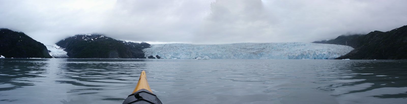
That's Tigertail Glacier on the left, and Chenega Glacier takes up most of the picture. I don't know how to even begin to try and get across the immensity of this glacier. It's about 1-1/4 miles wide at the face, and we never got closer than a mile or so from it. From the topo map, I'd say the cliff-like part of the face is about 500 feet high, and the ice itself reaches a height of over 2000' in 3 or 4 miles back from the face before it goes off my map. The cliff was the part that was calving, so big chunks of ice up to 500' tall were crashing off. It was overcast the whole time we were there, and raining much of the time, so visibility was very low and it was hard to take pictures. The color, especially, is off. The water was an odd shade of blue-green that almost looked like it was lit from a different light source. The glacier and many of the chunks of ice had a clear, brilliant blue color to them. The sky was grey, just like it looks.
There are bigger versions of this picture:
800 pixels wide
1600 pixels wide

<<

<

Current

>

>>