pano topo
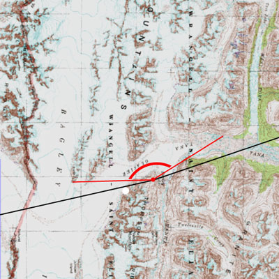
Here's the topographic map of the area in the last panorama (it's turned to match the photo, so west is at the top of the map), showing the same area, but from above. The black lines are the edges of the panorama, but the area between the red lines is really the effective field of view, since the hill we're on is blocking the rest.
You can see how we're right on the edge of the Bagley Icefield, and the mountains poking out of the icefield are just little blips in the ice... which you can't tell at all from where we were standing. Perspective makes a big difference.

<<

<

Current

>

>>