getting to the ice
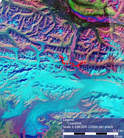
This is a satellite photo of the area we were hiking in, with our route marked in red dots (we started on the right). The cool blue is ice, and the larger areas of dark blue are water (primarily the river at the top). Browns, pinks, and greens are land with various kinds of vegetation (or lack of it). The brown areas are river valleys, even though they look raised. The dark blue/brown/cool blue veins are the mountains. You can see that we're right at the transition point between mountains and ice.

<<

<

Current

>

>>