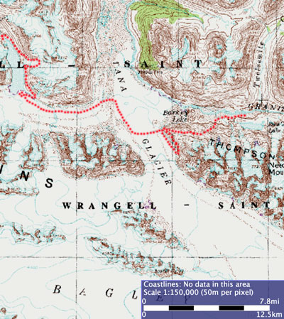
...or, another excuse to post a map. My apologies to those of you who aren't map geeks, but I can't help myself. All of these maps are from a very detailed online mapping program at GINA (Geographic Information Network of Alaska). It ranges from globe scale to 15 minute topo scale, and you can activate many different layers of information and background images. I've spent hours playing with it. Unfortunately for those at home, it's primarily aimed at Alaska, but it's great to see how speedy and user-friendly online mapping can be while still giving you access to a mind-boggling amount of mapping tools. Someday we'll have such flexible maps for search, too!
If you got to this picture from the home page, or by working backwards from Valdez, you'll want to view the backpacking pictures from the beginning.
There is one picture from a week before the backpacking trip, with a description of the park, which you might want to read if you hadn't already. Then if you want to skip the intervening week of the Denali Highway and Fairbanks, you can do so by going to the link for the beginning of the backpacking trip.
Or, you can go all the way to the beginning of the whole Alaska trip if you want to see all the pictures.

<<

<

Current

>